Geography |
|
Lesvos is one of the islands of the Northeast Aegean Sea. With a total area of 1.636 sq. klms, it is the third largest Greek island. It is situated 188 nautical miles from Piraeus, 218 nautical miles from Thessaloniki and 55 nautical miles from Chios. The island’s population is approximately 100.000, and the city of Mytilene is its administrative center – where the Prefectural Authority of Lesvos, the Ministry of Aegean Affairs, the Regional Administration of the North Aegean and the University of the Aegean are all located.Today, Lesvos has a total of 13 municipalities.
The island has two major bays – Gera Bay and Kalloni Bay – as well as a plethora of coves and peninsulas. Its most significant valleys are those of Kalloni, Ippeio, Perama and Eresos. Its highest mountains are Lepetymnos, Olympus and Psilokoudouno. The eastern and central part of the island is characterized by lush flora and fauna, which includes olive groves, dense pine and fir forests, as well as large formations of plane, chestnut and oak trees.
Climatologically, Lesvos has a mild, Mediterranean climate, with extensive periods of sunshine throughout the year. Its economy is based upon the local farming industry, and more specifically its olive groves that produce top quality olive oil, as well as its livestock and fresh fish. Another highly developed economic activity are the local distilleries, that produce our world famous ouzo, while the island’s tourism industry employs a large segment of the population on a part time basis.
Mandamados
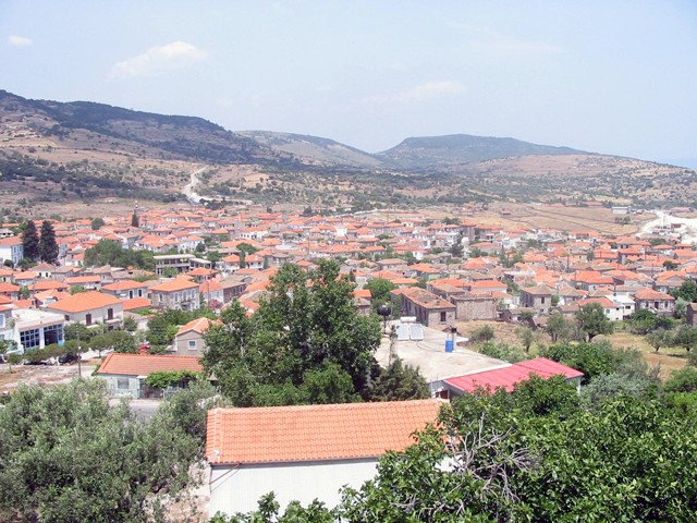
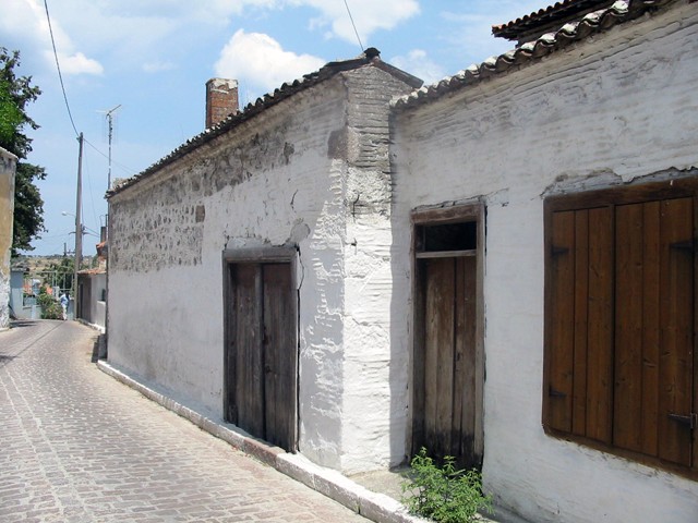
Mandamados is situated 37 klm from Mytilene, at 150 meters altitude above sea level. The town has been built in a small valley, and as such cannot be seen from a distance. This was done on purpose by its founders, so as to be well hidden from the coastline and marauding pirates. In order to further conceal the town from view, all the homes and other traditional structures were constructed from the local rock, and while the colors chosen for their decorations were selected in order to blend in with the surrounding flora. Most of its residents make a living farming the surrounding olive groves, and raising livestock, from which the town has taken its name (“mantas” is the word for “ox” in Turkish.)
 |
 |
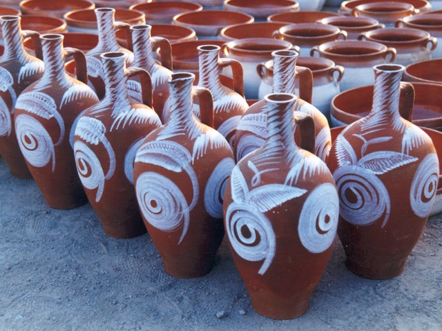
Here, pottery was one of the primary activities of the local population, and the “koumaria” vats were renown well beyond the island’s shores. This tradition is kept alive to this day, while the local craftsmen’s affinity for handicrafts also led to their specialization in olive wood carving. Mandamados also has a significant cultural heritage, as its residents have managed to preserve a significant repertoire of folk music, even more so than other towns that had larger chorales and traditional bands in decades past.
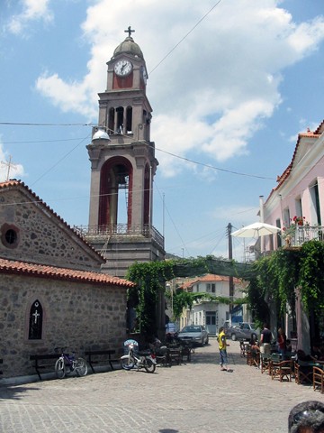
The church of Agios Vasilios (St. Basil), located in the town’s center, was built in 1750 and is quite interesting. Its intricately carved wood templon is one of the most impressive to be found in Greece’s churches.
 |
 |
The church of Agios Vasilios (St. Basil), located in the town’s center, was built in 1750 and is quite interesting. Its intricately carved wood templon is one of the most impressive to be found in Greece’s churches.

In you find yourself in our town’s main square, its definitely worth trying some of our quality dairy products, and especially the famous Mandamados yogurt, that’s still made according to our traditional recipe, and is served in the traditional clay “gravoudes”.